Brazoria County, Texas — property and whole-system planning
Water Well Drilling in Brazoria County, TX
TurnKey Wells helps Brazoria County property owners turn county well records into property-specific questions and a clear drilling estimate. Tell us where the property is, what the well needs to support, and what access, drainage, pressure, treatment, storage, or delivery constraints already matter.
- Address-based project intake
- Property-specific planning
- Clear next steps
Screening land in Brazoria County? Start with public records, then tie the comparison to the exact property.
What 9,012 positive-depth household records tell you
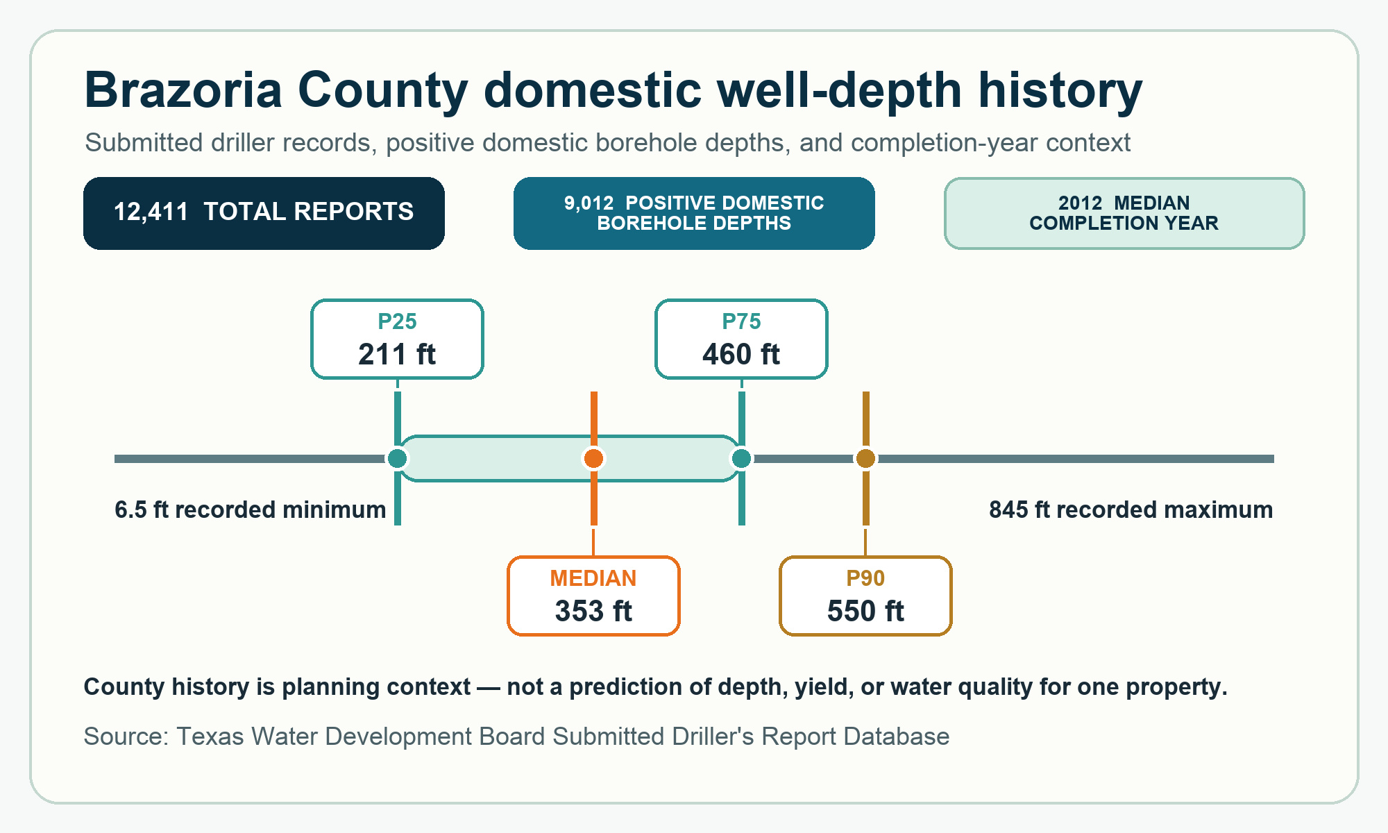
Brazoria County has 9,014 domestic reports, and 9,012 include a positive borehole depth. Those positive-depth logs have a 353-foot median. Their middle half runs from 211 to 460 feet, the calculated 90th-percentile marker is 550 feet, and the full recorded positive range is 6.5 to 845 feet.
This record set is useful planning context, but it is not a property estimate. Nearby comparable records, intended demand, access and drainage, casing and sealing choices, pump setting, utilities, pressure equipment, treatment or storage needs, source documents, and site conditions still belong in the review.
Data source: Texas Water Development Board Submitted Driller’s Report Database.
Recorded domestic borehole depths
The middle half of 9,012 positive reported domestic depths
Brazoria County’s well file serves several purposes
Brazoria County’s 12,411 submitted reports include 9,014 domestic, 1,408 monitoring, 397 environmental soil-boring, 373 stock, 285 irrigation, 224 public-supply, 214 rig-supply, 196 industrial, 150 other-use, 101 test-well, 33 injection, 15 closed-loop geothermal, and one de-watering record. Keep those purposes separate so non-household work does not distort household planning.
Domestic records
9,012 domestic filings include a positive depth. Those values have a 353-foot median and a 211-to-460-foot middle band.
Monitoring records
All 1,408 filings include a positive depth, with a 25-foot median tied to monitoring rather than household demand.
Environmental soil-boring records
All 397 filings include a positive depth, with a 15-foot median and a separate investigative purpose.
Stock records
All 373 filings include a positive depth, with a 145-foot median and a separate demand profile.
Irrigation records
All 285 filings include a positive depth, with a 182-foot median and a separate demand profile.
The remaining mix includes 224 public-supply, 214 rig-supply, 196 industrial, 150 other-use, 101 test-well, 33 injection, 15 closed-loop geothermal, and one de-watering record. Those categories provide context without replacing a domestic comparison.
Brazoria County records need to be sorted by purpose
A countywide average that blends household wells with monitoring, environmental soil-boring, stock, irrigation, public-supply, rig-supply, industrial, other-use, test-well, injection, closed-loop geothermal, and de-watering filings is not a clean comparison. Household planning should begin with the domestic records.
The complete Brazoria County job is more than drilling footage
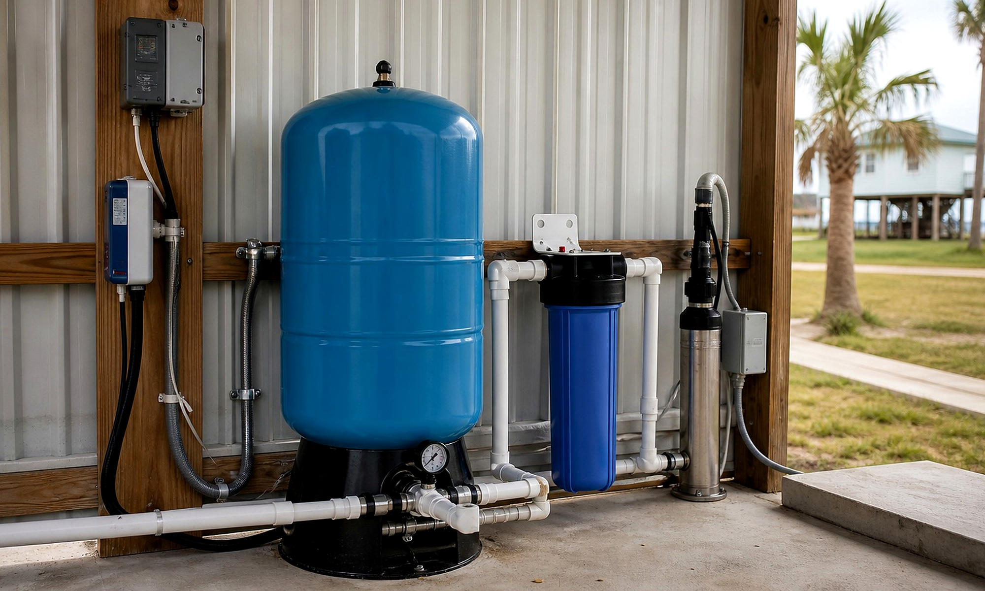
Gate width, road conditions, overhead lines, septic placement, distance to power, intended demand, and equipment choices all belong in the plan.
Property access
Roads, gates, low branches, overhead lines, utility conflicts, turning room, drainage, and a safe stabilized work pad.
Water demand
Household use, livestock, irrigation, storage, treatment, and peak daily needs.
Pump and power
Pump selection, anticipated drawdown, electrical service, controls, pressure equipment, line runs, and trenching.
Complete installation
Casing, completion materials, testing, storage, plumbing, treatment, cleanup, and startup.
Build the estimate around what the Brazoria County property actually needs.
Share the address, intended use, access, timing, and any existing well information. TurnKey Wells reviews the project context and connects the owner with a qualified water-well professional for the next step.
Separate drilling footage from the finished system
A complete Brazoria County budget may include mobilization, drilling, casing, completion materials, pump and controls, pressure equipment, trenching, electrical work, storage, testing, treatment, drainage, and cleanup. The Texas water well drilling cost guide explains the major categories behind a headline estimate.
The Pre-Drill Report can bring nearby well records and property details into one review, but no county pattern predicts the producing interval, total depth, water level, yield, salinity, or water quality at one property. Use property-specific research before treating a county pattern as a drilling plan.
- Mobilization and setup
- Drilling and casing
- Pump and controls
- Pressure equipment
- Power and trenching
- Storage and treatment
- Water testing
- Site cleanup
Pre-Drill Intelligence Report
The county information on this page shows broad patterns. The paid report narrows the research to one Brazoria County property before you compare drilling quotes or choose the next step for your land.
- Nearby recorded wells and reported depths
- Property access and site-planning questions
- Questions to ask before drilling begins
- A clearer picture of the complete water system
Understand the ground before you drill. Property conditions can change across the county. A property-specific review brings nearby well records, location, intended use, access, and complete-system questions together before you request a drilling quote.
From property address to drilling conversation
Tell us about the property
Share the address, how the water will be used, and when you hope to begin.
We review the project
We look at the location and follow up for any details needed to discuss the estimate.
Plan the drilling work
You receive a clear next step for the drilling quote and complete water system.
Plain answers before you plan the work
What do Brazoria County household well records show?
The county file includes 9,012 positive domestic borehole-depth logs with a 353-foot median, a 211-to-460-foot middle band, a 550-foot calculated 90th percentile, and a 6.5-to-845-foot full range.
Why should Brazoria County records be separated by use?
The file includes domestic, monitoring, environmental soil-boring, stock, irrigation, public-supply, rig-supply, industrial, other-use, test-well, injection, closed-loop geothermal, and de-watering filings. Keeping each purpose separate avoids turning non-household work into a household expectation.
Does a countywide depth pattern predict one property?
No. County records do not prove the producing interval, total depth, water level, yield, salinity, or water quality at one property.
What property details help start a Brazoria County review?
Provide the exact address or coordinates, intended water use, access, turning and drainage constraints, utilities, wastewater components, desired pressure, treatment or storage needs, and any nearby well documents you already have.
What should a complete drilling quote include?
Compare mobilization, drilling, casing, completion materials, pump and controls, pressure equipment, electrical and trenching work, testing, treatment or storage where needed, elevation and drainage details, startup, and cleanup.
Water well planning across Brazoria County
Property questions begin around Pearland, Alvin, Angleton, county roads, homesites, and acreage between them. Start with the exact address or coordinates, intended water use, access and drainage, utilities, wastewater components, and nearby domestic records; a community label does not prove shared subsurface conditions, water quality, yield, or private-well feasibility.
Tell us about your Brazoria County property.
Send the basics and we will follow up to learn what you need, answer initial questions, and discuss the next step toward a water well drilling quote.
- No long questionnaire
- A real follow-up about your property
- Clear options for drilling and pre-drill planning
Request a Water Well Drilling Quote
Tell us where the property is and what the well needs to support.
Your information is used to respond to this request. Privacy Policy