Wilson County, Texas — South Texas pasture, ranch access, and complete-system planning
Water Well Drilling in Wilson County, TX
Use Wilson County records and exact property details to prepare better questions and a clear drilling quote. Share the address or coordinates, intended demand, road and gate access, staging conditions, utilities, power, pressure, storage, treatment, trenching, and delivery needs.
- Exact property intake
- County depth comparisons
- Complete-system scope
Evaluating a homesite, pasture, ranch tract, or changing parcel in Wilson County? Start with county records, then tie every comparison to access, utilities, demand, and the exact property.
What 2,094 positive-depth domestic records show
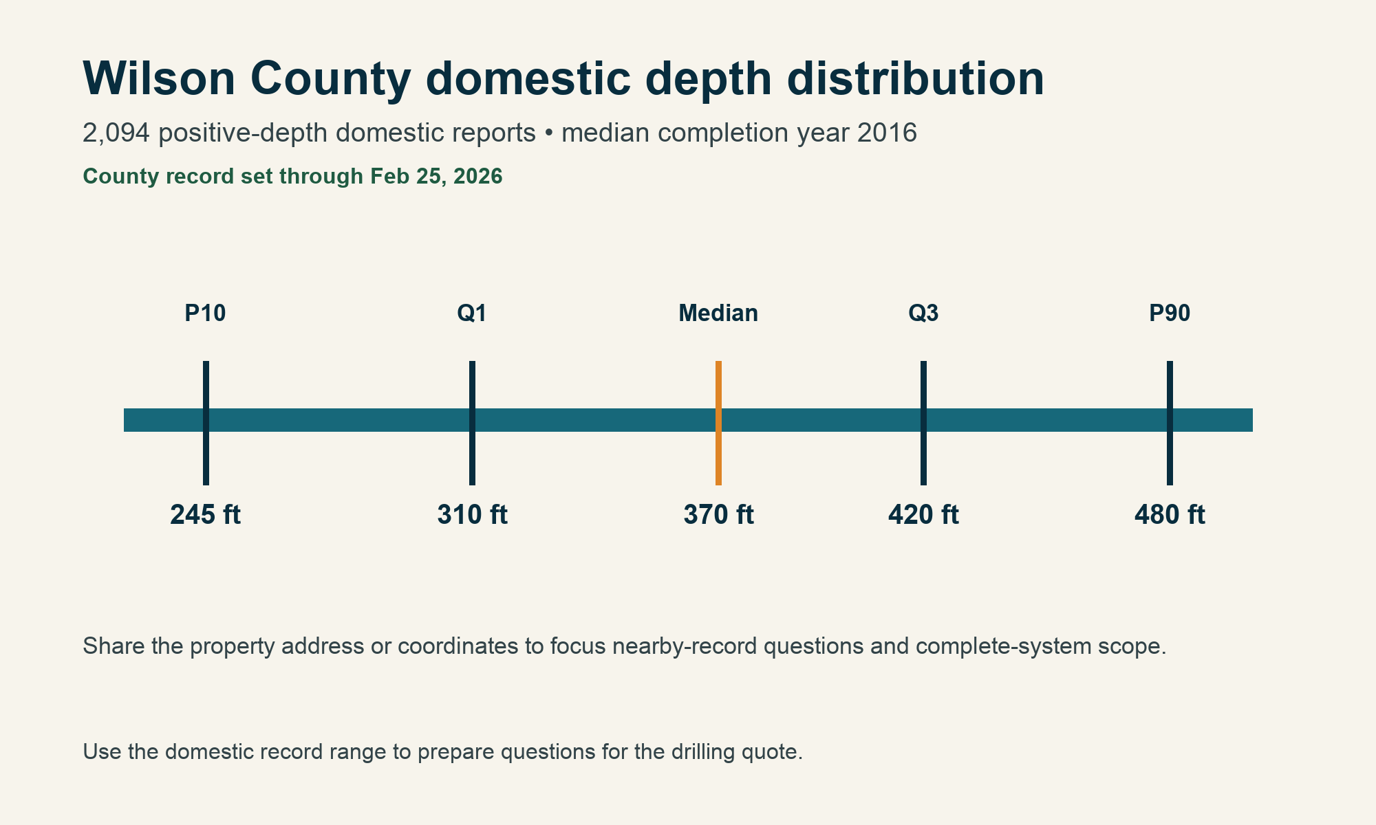
The Wilson County file contains 2,096 domestic-use reports, including 2,094 with a positive borehole depth. The middle half runs from 310 to 420 feet, with a 370-foot median; P10 is 245 feet and P90 is 480 feet. The median domestic completion year is 2016, and the latest submitted date in the county summary is February 25, 2026.
Population estimates rose from 50,051 in 2020 to 55,415 in 2024—an increase of 5,364 residents, or 10.72%. Property change can tighten access, alter utilities and drainage, and make coordination with power, septic, structures, trenching, storage, and future site work more important.
County records help frame questions; the drilling quote is built from the property location, access, demand, and complete-system scope.
Wilson County’s well file includes different work categories
Domestic records belong in the household review lane. Stock, irrigation, environmental, monitoring, public-supply, rig-supply, industrial, and fracking-supply filings serve different purposes. Specialized categories should not become household expectations.
Domestic records
2,094 positive depths; 370-foot median and a 310–420-foot middle band.
Stock records
Median 340 feet; livestock demand differs from household use.
Irrigation records
Median 490 feet; a separate demand and equipment profile.
Environmental records
Median 17 feet; investigation work, not household supply.
Monitoring records
Median 30 feet; a monitoring purpose.
Public-supply records
Median 935 feet; not a household benchmark.
Rig-supply records
Median 452 feet; a separate operational purpose.
Industrial records
Median 466 feet; an industrial purpose.
Fracking-supply records
Median 2,550 feet; specialized work kept separate from domestic comparisons.
Start with the domestic distribution
Blending household records with stock, irrigation, environmental, monitoring, public-supply, rig-supply, industrial, or fracking-supply work creates a misleading average.
The complete Wilson County job is more than drilling footage
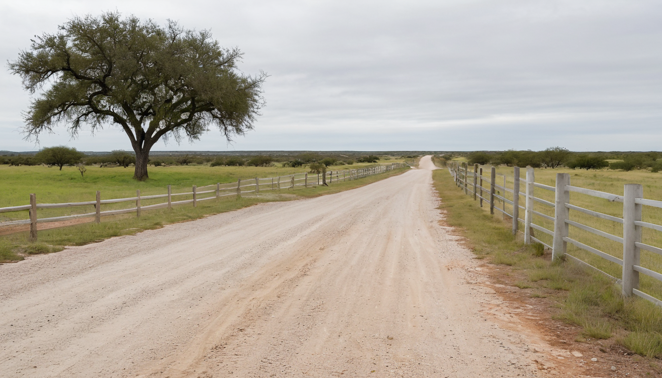
South Texas pasture and ranch acreage needs deliberate access and staging: all-weather road base, gate width, turning geometry, overhead clearance, caliche or soil work-pad conditions, utilities, power, septic, drainage, neighbors, and future construction all belong in the review.
Access and staging
All-weather road condition, gate width, turning room, overhead lines, and a firm level pad for the drill truck and support vehicle.
Demand and storage
Household use, livestock, irrigation, fire reserve, storage, treatment, and peak daily needs.
Pump, power, and pressure
Pump selection, anticipated lift and drawdown, electrical service, controls, pressure equipment, line runs, and trenching.
Finished system
Mobilization, drilling, casing, completion materials, testing, pump and controls, storage or treatment, startup, and cleanup.
Build the estimate around what the Wilson County property actually needs.
Send the exact location, intended water use, access constraints, power and utility details, and known parcel plans.
Separate drilling footage from the finished system
A complete Wilson County budget may include mobilization, stable-pad setup, drilling, casing, completion materials, pump and controls, pressure equipment, trenching, electrical work, storage, testing, treatment, startup, and cleanup. The Texas water well drilling cost guide explains the major categories behind a headline estimate.
The GWDB reference set contains 520 Wilson County records. Aquifer classifications include 301 Carrizo-Wilcox, 139 unassigned, 46 Queen City, 15 Sparta, 12 other, and 7 Yegua-Jackson records. Share the address or coordinates so nearby-record comparisons can focus on the property.
All 520 records in that set are listed with Evergreen Underground Water Conservation District. Share the exact property location early so the applicable property review, access, and scheduling questions can be addressed before mobilization.
- Mobilization and stable-site setup
- Drilling and casing
- Pump and controls
- Pressure equipment
- Power and trenching
- Storage and treatment
- Water testing
- Startup and cleanup
Pre-Drill Intelligence Report
The county information on this page shows broad patterns. The paid report narrows the research to one Wilson County property before you compare drilling quotes or choose the next step for your land.
- Nearby recorded wells and reported depths
- Property access and site-planning questions
- Questions to ask before drilling begins
- A clearer picture of the complete water system
Understand the ground before you drill. Property conditions can change across the county. A property-specific review brings nearby well records, location, intended use, access, and complete-system questions together before you request a drilling quote.
From exact property details to a drilling conversation
Tell us about the property
Share the address or coordinates, intended use, access and staging, utilities, power, structures, septic context, and known site plans.
We review the project
TurnKey Wells screens the request, clarifies the scope, and identifies missing details that affect mobilization or the finished system.
Plan the drilling work
Review the drilling quote against the defined scope, equipment, materials, site work, and finished-system items.
Plain answers before you plan the work
What do Wilson County domestic well records show?
The county file includes 2,094 positive domestic borehole-depth records with a 370-foot median, a 310-to-420-foot middle band, P10 at 245 feet, and P90 at 480 feet.
Why separate Wilson County records by use?
The file includes domestic, stock, irrigation, environmental, monitoring, public-supply, rig-supply, industrial, fracking-supply, and other filings. Each category supports different buyer questions; compare domestic records when discussing household use.
Why is the exact property location important?
The address or coordinates help focus nearby-record comparisons and define access, demand, power, storage, treatment, and complete-system scope for the review.
What access details help start a Wilson County review?
Provide the exact address or coordinates, road and gate widths, surface and all-weather condition, turning and staging room, overhead lines, utilities, power, septic components, planned structures, drainage constraints, and nearby properties.
What should a complete drilling quote include?
Compare mobilization, stable-pad setup, drilling, casing, completion materials, pump and controls, pressure equipment, electrical and trenching work, testing, treatment or storage where needed, startup, and cleanup.
Water well planning across Wilson County
Floresville, La Vernia, Poth, and Stockdale are the primary county places in this guide. Nixon, Elmendorf, St. Hedwig, and New Berlin overlap Wilson County but are not primary by area. Share the exact property location so the review can focus on relevant nearby records, access, utilities, occupied surroundings, and complete-system needs.
Tell us about your Wilson County property.
Send the basics and TurnKey Wells will follow up to clarify the scope and discuss the next step toward a drilling quote.
- No long questionnaire
- A real follow-up about the property
- Clear options for drilling and pre-drill planning
Request a Water Well Drilling Quote
Tell us where the property is and what the well needs to support.
Your information is used to respond to this request. Privacy Policy