Texas High Plains groundwater planning
The Ogallala Aquifer in Texas
A practical guide to High Plains groundwater, well depth, saturated thickness, depletion, water quality, groundwater district rules, and what to check before buying or drilling on Panhandle and South Plains land.
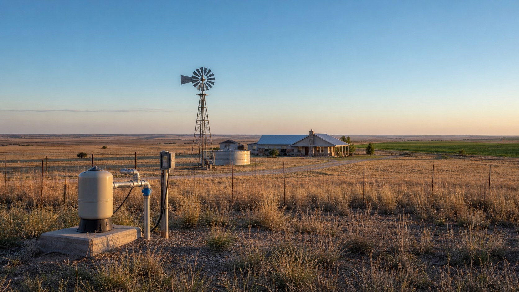
The Ogallala Aquifer is the groundwater system that made modern High Plains agriculture possible. In Texas, it underlies much of the Panhandle and South Plains, including ranch country, irrigated cropland, small towns, rural homesteads, feedyards, dairies, and acreage tracts where a private well can decide whether a property works or does not. For a land buyer, ranch owner, or agent trying to evaluate rural property in this part of Texas, the Ogallala is not just a map layer. It affects water availability, well depth, pumping capacity, treatment needs, permit requirements, and long-term property risk.
The key point is simple: the Ogallala is not gone everywhere, and it is not strong everywhere. Some Texas High Plains areas still support productive domestic, livestock, municipal, and irrigation wells. Other areas have lost enough saturated thickness that high-capacity pumping is no longer realistic, and even domestic wells require more careful planning. County averages help with orientation, but property-level outcomes depend on saturated thickness, local sand and gravel thickness, nearby well records, existing pumping stress, groundwater district rules, and the intended use of the well.
Quick Facts About the Ogallala Aquifer in Texas
| Planning Item | Practical Property Owner Meaning |
|---|---|
| Aquifer type | Mostly unconsolidated sand, gravel, silt, and clay deposits that store water in pore spaces between sediment grains |
| Geologic age | Late Tertiary and Quaternary High Plains deposits, commonly associated with the Ogallala Formation and younger related sediments |
| Main Texas region | Texas Panhandle and South Plains, extending from the northern Panhandle south through the Lubbock region and parts of the southern High Plains |
| Common well use | Domestic supply, livestock, municipal water, irrigation, dairies, feedyards, and rural business operations |
| TurnkeyWells GWDB records tagged Ogallala | 22,545 records explicitly identify Ogallala or mixed Ogallala aquifer names |
| TurnkeyWells SDR records inside the footprint | 129,271 submitted driller report records fall inside the official TWDB Ogallala major-aquifer boundary, useful as a geographic well-record sample but not a confirmed completion count |
| Typical domestic well depth | Often 100 to 400 feet, with shallower and deeper exceptions depending on county, land surface elevation, and remaining saturated thickness |
| High-capacity well depth and yield | Highly variable. Productive irrigation wells may produce hundreds of gallons per minute where saturated thickness remains, but stressed areas can produce far less |
| Recharge | Slow and limited under semi-arid High Plains conditions, with recharge affected by playa basins, soils, rainfall, and land use |
| Primary risk | Long-term water-level decline and reduced saturated thickness from decades of pumping, especially irrigation pumping |
| Common water quality concerns | Hardness, total dissolved solids, nitrate in agricultural areas, salinity in some zones, and localized naturally occurring minerals |
| Regulatory check required | Many properties are inside Groundwater Conservation Districts with registration, spacing, permit, or production rules |
What the Ogallala Is and Where It Is in Texas
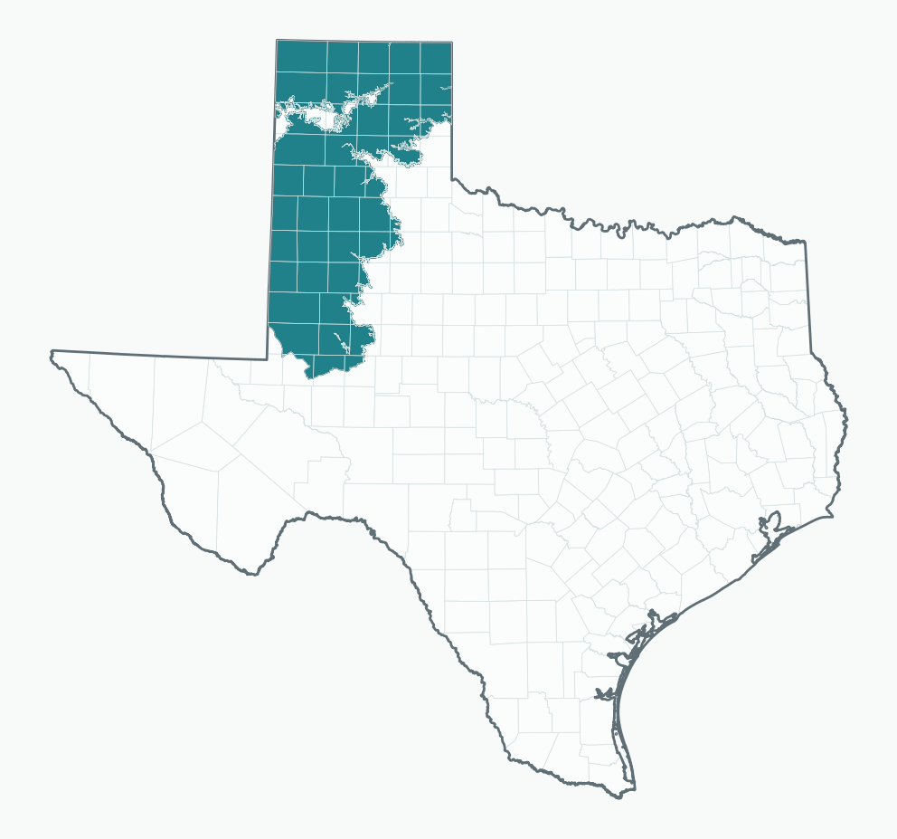
The Ogallala Aquifer is the Texas portion of the larger High Plains Aquifer system, one of the most important groundwater systems in North America. Across the Great Plains, it extends through multiple states. In Texas, it occupies the High Plains landscape across the Panhandle and South Plains, including areas around Amarillo, Dumas, Dalhart, Hereford, Plainview, Lubbock, Levelland, Brownfield, Seminole, and surrounding rural counties.
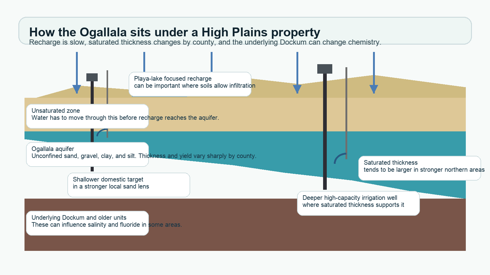
Unlike limestone aquifers that store water in fractures, caverns, or solution channels, the Ogallala stores water mostly in unconsolidated and partly consolidated sediments: sand, gravel, silt, and clay. Water moves through the spaces between those particles. A productive well depends on how thick the saturated sediments are, how continuous the sand and gravel zones are, and how much water can move toward the well screen without excessive drawdown.
The aquifer formed as rivers and streams carried sediment eastward from the Rocky Mountain region and deposited it across the High Plains. Over time, those deposits filled older valleys and covered the surface with layers of sand, gravel, silt, and clay. In many Texas counties, the aquifer is unconfined, which means the water table is open to atmospheric pressure and rises or falls with recharge and pumping. That also means the aquifer behaves differently from deeper confined systems like the Trinity Aquifer or Carrizo-Wilcox Aquifer. When water levels decline in an unconfined aquifer, saturated thickness shrinks directly.
The History of the Ogallala Aquifer in Texas
The Ogallala story in Texas starts long before wells and center pivots. The aquifer is the water-bearing part of High Plains sediment laid down by ancient river systems that carried sand, gravel, silt, and clay east from the Rocky Mountain region. Those deposits became the geologic bank account that later supported towns, ranches, farms, and rural homes across the Texas Panhandle and South Plains.
The name Ogallala comes from geologic work in the late 1800s near Ogallala, Nebraska, but the Texas story is really a High Plains land-use story. Early settlement depended on windmills, shallow wells where available, stock water, dryland farming, and careful timing with rainfall. Groundwater was valuable, but it did not yet drive the scale of agriculture that came later.
Ogallala Timeline for Texas Landowners
This history matters because old assumptions still show up in land conversations. Some sellers remember when irrigation wells were stronger. Some buyers hear that the Ogallala is disappearing and assume no well will work. Neither shortcut is reliable. The practical answer is local: compare older records with newer records, look at nearby depths and yields, check current district rules, and separate domestic-water needs from irrigation-scale expectations.
For a Texas property buyer, the historical pattern is a warning against treating past production as a permanent promise. A well that supported heavy pumping decades ago may not describe current conditions. A domestic well in the same area may still be perfectly usable. That is why the rest of this page focuses on saturated thickness, well records, water quality, and district rules instead of broad slogans about the aquifer.
Why the Ogallala Matters for Panhandle Property Owners
In the Texas High Plains, groundwater is often the difference between usable and limited land. A rural home may need a domestic well because no public supply reaches the tract. A stock operation may need reliable livestock water across several pastures. A farm may depend on irrigation capacity to support crop choices and land value. A buyer looking at acreage near a county road may see a nice tract, but the water record underneath it can tell a very different story.
The Ogallala also affects resale. Buyers increasingly ask harder questions about existing wells, water rights, groundwater district rules, and long-term availability. A property with a functioning well, usable water quality, and nearby records showing stable domestic supply has a different risk profile than a tract where neighboring wells are deep, low-yield, or historically tied to heavy irrigation decline. Sellers and agents do not need to become hydrogeologists, but they do need enough context to avoid sloppy claims like “good water everywhere” or “the Ogallala is dried up.” Both statements can be wrong depending on the local area.
For drilling decisions, the Ogallala rewards local evidence. A one-mile or three-mile radius of nearby well records can show whether wells cluster around 180 feet, 350 feet, or much deeper. It can also show whether the reported uses are domestic, irrigation, livestock, or public supply. Those records do not guarantee a result on the target property, but they give a buyer or owner a much better starting point than a county-wide average.
What TurnkeyWells Records Show on the Ogallala
The TurnkeyWells database gives this page a more useful starting point than a generic aquifer summary. In the GWDB table, 22,545 Texas well records are explicitly tagged with Ogallala or a mixed Ogallala aquifer name. That is the safest count to use when asking how many indexed groundwater database records identify the Ogallala as the aquifer source. Of those records, 17,029 include a usable depth value. The average recorded depth across that usable sample is 270 feet, the median is 220 feet, and the middle 80 percent of records run from about 99 feet to 505 feet.
The submitted driller report table is larger, but it does not carry an aquifer-name field. To make that data useful, TurnkeyWells overlaid the SDR well locations against the official TWDB major-aquifer boundary. That geographic check found 129,271 SDR records inside the Ogallala footprint, plus 38,878 plugged well records inside the same footprint. Those are not the same as confirmed Ogallala completions, because a point inside the footprint can still involve local drilling details that the SDR table does not name. They are still valuable because they show the density of well activity across the land area where the Ogallala is the major aquifer context.
The use mix also matters. In the GWDB Ogallala-tagged records, irrigation is the largest category by a wide margin, with 12,427 records. Domestic wells account for 2,010 records, stock wells for 2,005 records, and public supply wells for 1,195 records. That mix explains why the Ogallala conversation can sound different depending on who is talking. A farmer thinking about irrigation capacity, a rural homeowner checking household supply, and a town evaluating municipal water all ask different questions from the same aquifer.
Well Depth and Yield in the Texas Ogallala
Ogallala well depth varies sharply across the Texas High Plains. In some South Plains areas, domestic wells may be completed around 100 to 250 feet. In parts of the central and northern Panhandle, well depths of several hundred feet are common. Local GWDB records tagged Ogallala show broad county variation: Gaines County averages about 168 feet across 1,746 records, Randall County averages about 242 feet across 1,471 records, Swisher County averages about 218 feet across 1,385 records, Deaf Smith County averages about 312 feet across 997 records, Carson County averages about 579 feet across 946 records, and Moore County averages about 502 feet across 602 records. Those averages mix use types and record quality, so they should guide expectations, not replace a parcel-level review.
Yield varies even more than depth. A domestic home well may only need enough water for household demand, a pressure tank, and normal outdoor use. A livestock well may need steady production but not irrigation-scale flow. An irrigation well, by contrast, may need hundreds of gallons per minute to justify the equipment and energy cost. The same aquifer can support all three uses in one county while struggling to support high-capacity production in another local area.
When exact local yield data is not available, property owners should treat yield claims carefully. Reported gallons per minute in old records may reflect the well’s original test, not current performance after years of decline. Pump size, screen interval, drawdown, well age, and maintenance all affect what a well produces today. A current pump test and water-level measurement are the right tools for confirming an existing well’s performance.
Representative Planning Ranges by County
| County or Area | Representative Planning Depth | Yield Planning Notes | Property Owner Takeaway |
|---|---|---|---|
| Gaines County | GWDB Ogallala sample averages 168 feet across 1,746 records | Large irrigation record count, but domestic and stock uses also appear | Strong county sample, but parcel-level saturated thickness still decides risk |
| Randall County | GWDB Ogallala sample averages 242 feet across 1,471 records | Mixed municipal, domestic, irrigation, and rural-property context | Check local GCD rules and nearby water-level trend before relying on old records |
| Swisher and Briscoe counties | GWDB Ogallala samples average about 218 feet in Swisher and 204 feet in Briscoe | High Plains agricultural use is significant, with local saturated-thickness variation | Separate household-water needs from irrigation-scale expectations |
| Deaf Smith County | GWDB Ogallala sample averages 312 feet across 997 records | Irrigation history and livestock demand make current capacity important | Ask for recent pump tests and compare newer wells against older wells |
| Carson and Moore counties | GWDB Ogallala samples average about 579 feet in Carson and 502 feet in Moore | Deeper completions and competing municipal, industrial, and agricultural demand can matter | Do not price or design a well from regional averages alone |
| Lubbock, Lamb, Hale, Bailey, and Dawson counties | GWDB Ogallala county averages in this sample range from about 143 to 271 feet | Urban-edge, rural residential, and farm uses create mixed records | Nearby wells matter more than the county name |
| Dallam and Sherman counties | GWDB Ogallala samples average about 374 feet in Dallam and 456 feet in Sherman | Productivity can remain strong where saturated thickness supports it, but depletion and spacing matter | Check North Plains area rules and recent local records before relying on irrigation capacity |
| Gray and Hemphill counties | GWDB Ogallala samples average about 382 feet in Gray and 251 feet in Hemphill | Local structure, river valleys, and demand patterns can change the practical well result | Use a property-level report rather than a broad Panhandle assumption |
These ranges are planning language, not a quote and not a drilling guarantee. A licensed driller may recommend a different target depth after reviewing local logs, nearby wells, geophysical data, or property access conditions. The right question is not “How deep is the Ogallala?” It is “What have the nearest relevant wells found, and how much water do they produce now?”
Depletion and Saturated Thickness: The Practical Version
The Ogallala’s biggest issue in Texas is not mystery. Pumping has exceeded recharge across many High Plains areas for decades, especially where irrigation demand has been intense. Because recharge is slow and limited in the semi-arid Panhandle climate, heavy pumping lowers water levels faster than natural recharge can replace them. Over time, the saturated thickness of the aquifer declines.
Saturated thickness means the vertical thickness of aquifer material that remains filled with water. A well completed in 250 feet of saturated sand and gravel has a very different outlook than a well completed in 25 feet of saturated material. Thicker saturated zones can provide more storage and better yield. Thin saturated zones are more vulnerable to seasonal drawdown, neighbor pumping, drought stress, and pump setting limitations.
This is where broad Ogallala headlines can mislead property owners. The aquifer has severe declines in some Texas areas. In other areas, it remains productive for domestic, livestock, municipal, or even agricultural uses. A parcel near a productive well field may have a strong water outlook. Another parcel in the same county, several miles away, may sit over thin remaining saturated material. The difference can change the economics of a land purchase.
For property due diligence, ask for three pieces of evidence: nearby well depths, current or recent water-level data, and reported yields by use type. If the property has an existing well, ask for the static water level, pumping level, pump depth, well depth, casing details, age, repair history, and any recent pump test. If the property is unimproved, review wells within a practical radius and compare older records to newer records. A pattern of deeper newer wells or declining reported performance can be more useful than a single impressive old irrigation record.
Water Quality in the Ogallala
Ogallala water quality in Texas is often usable, but it is not uniform. Water chemistry changes with depth, local sediments, recharge pathways, agricultural history, and proximity to areas affected by salinity or nitrate. A well that works fine for livestock may still need treatment for household drinking water. A well that tastes fine may still need lab testing before a buyer relies on it for a home.
Hardness and total dissolved solids are common planning issues. Hard water can scale plumbing, water heaters, fixtures, and irrigation equipment. Elevated TDS can affect taste and may matter for certain livestock, irrigation, or household uses. In some areas, salinity increases where groundwater has longer residence time or where local geology contributes more dissolved minerals.
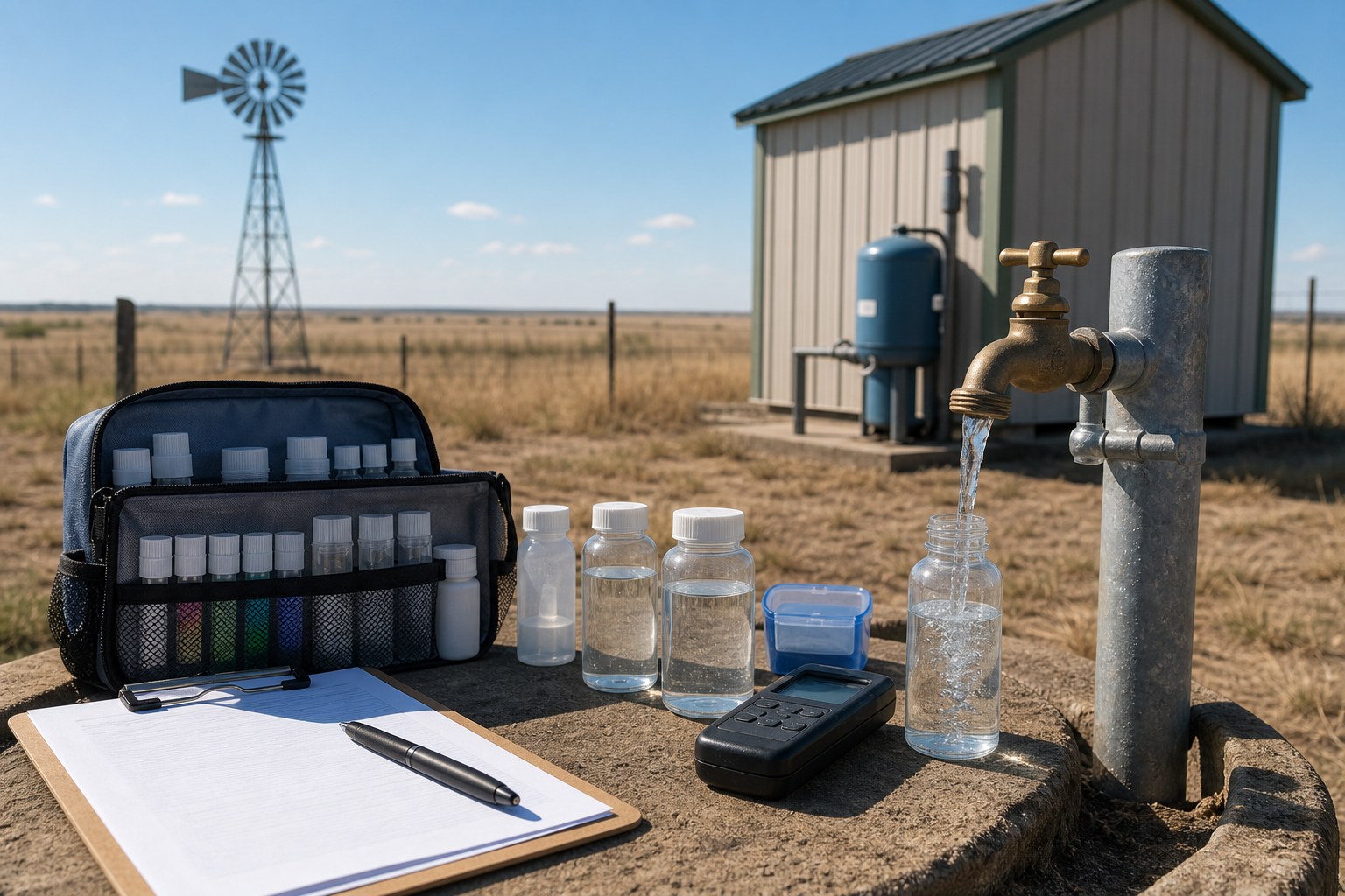
Nitrate deserves special attention in agricultural parts of the High Plains. Fertilizer, septic systems, livestock operations, and historic land use can contribute nitrate to shallow groundwater in vulnerable settings. Nitrate is a health concern for drinking water, especially for infants, and it requires testing rather than guesswork. Bacteria testing also matters for any domestic well, particularly where the wellhead, casing seal, or nearby surface drainage is questionable.
The right treatment system depends on the actual lab result. A softener can address hardness, but it does not solve nitrate or bacteria. Reverse osmosis may address certain dissolved constituents for drinking water, but it does not replace whole-house treatment where the issue affects plumbing or livestock use. Before installing treatment, test first and design around the results.
Groundwater Districts and Permitting
Groundwater Conservation Districts are a major part of Ogallala property planning in Texas. Districts can require well registration, drilling permits, spacing setbacks, production permits, annual reporting, metering for larger wells, and conservation rules. Domestic and livestock wells may be exempt from some production permits in many districts, but exemption does not always mean no paperwork. Irrigation, commercial, municipal, dairy, feedyard, and industrial wells usually face more formal review.
Representative districts in the Texas Ogallala region include High Plains Underground Water Conservation District No. 1, Panhandle Groundwater Conservation District, North Plains Groundwater Conservation District, Mesa Underground Water Conservation District, Sandy Land Underground Water Conservation District, Llano Estacado Underground Water Conservation District, Gateway Groundwater Conservation District, Hemphill County Underground Water Conservation District, and Garza County Underground Water Conservation District. This is not a complete rule summary, and district boundaries do not follow aquifer edges neatly. A property can sit near a boundary, outside a district, or inside a district with rules that differ from a neighboring county.
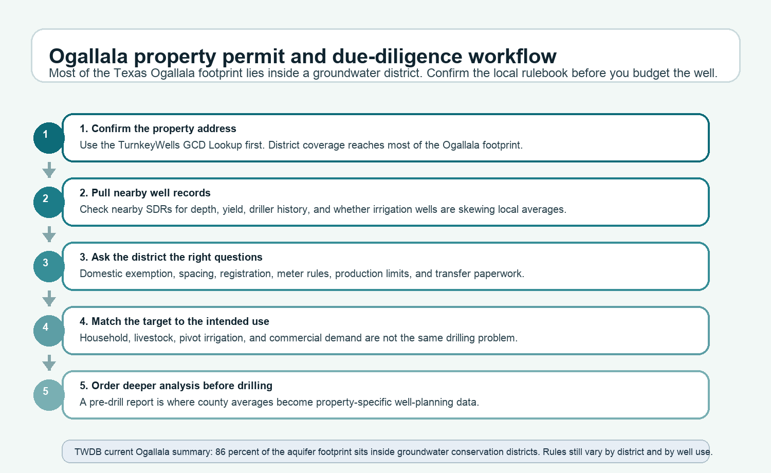
Before buying, drilling, deepening, replacing a pump, or converting a domestic well to a higher-volume use, confirm the applicable district and current requirements. The easiest first step is the TurnkeyWells Free GCD Lookup. After that, contact the district directly before relying on any exemption or permit assumption.
Check the Groundwater District Before You Drill
Panhandle and South Plains wells often fall under local GCD rules. Confirm the district before you assume a domestic exemption, irrigation permit, spacing rule, or production limit.
Counties and Areas on the Ogallala in Texas
The Ogallala footprint in Texas includes much of the Panhandle and South Plains. The areas below are listed as regional planning groups because groundwater conditions, district rules, and nearby well records vary by parcel even inside the same county.
Northern Panhandle
Dallam, Hartley, Sherman, Moore, Hansford, Ochiltree, Lipscomb, Hutchinson, Roberts, and Hemphill counties all sit in the northern High Plains groundwater conversation. This region includes major ranching, farming, feedyard, and municipal demand. Productive wells still exist, but saturated thickness and district rules vary sharply.
Central Panhandle
Oldham, Potter, Carson, Gray, Wheeler, Deaf Smith, Randall, Armstrong, Donley, and Collingsworth counties include a mix of ranch properties, Amarillo-area development, rural homesites, irrigation, and livestock operations. Buyers should treat water due diligence as part of the land evaluation, not as an afterthought after contract.
South Plains and Llano Estacado
Parmer, Castro, Swisher, Briscoe, Bailey, Lamb, Hale, Floyd, Cochran, Hockley, Lubbock, Crosby, Yoakum, Terry, Lynn, Garza, Gaines, Dawson, and nearby southern High Plains counties include some of the most important agricultural areas in Texas. Historic irrigation demand has shaped the groundwater record, and domestic buyers need to separate household water expectations from irrigation-scale claims.
What This Means Before Buying or Drilling
If you are buying property on the Ogallala, do not stop at “has a well” or “well available.” Ask what kind of well it is, when it was drilled, how deep it is, where the pump is set, what it produced when tested, whether it has a recent pump test, and whether water quality has been tested. Ask whether the well is registered with the GCD and whether the registered owner matches the current property history. For a land transaction, those details can prevent confusion later.
If you are drilling, start with the data before you start with the rig. Pull nearby well records. Confirm the GCD. Ask drillers what they have completed within a few miles of the property, not just in the same county. Ask whether the intended use is domestic, livestock, irrigation, or commercial, because the answer affects permit rules, pump design, storage needs, and project risk. A modest domestic well and an irrigation well are not the same decision.
For existing wells, understand that original construction records may not describe current performance. A well drilled decades ago may still serve a home reliably, but the pump, casing, screen, wiring, pressure tank, sanitary seal, and water chemistry all deserve review. If the purchase depends on the well, a current inspection and test provide more value than a verbal assurance.
Using TurnkeyWells for Ogallala Property Research
TurnkeyWells is built for this exact problem: turning Texas well records, GCD boundaries, aquifer information, and property-specific risk factors into usable due diligence. The Ogallala requires that kind of property-level review because the range of possible outcomes is wide. A good tract in a strong saturated-thickness area and a risky tract in a depleted area can look similar from the road.
The Free Well Check is the quick starting point. It searches registered well records near a Texas address and helps identify whether nearby wells exist, how deep they are, and what the local record pattern looks like. The Pre-Drill Intelligence Report goes further by organizing nearby well depth, use, driller, aquifer, GCD, and risk context for a specific property. The Free GCD Lookup helps confirm which groundwater district governs the tract.
Research an Ogallala Property Before You Commit
Before you buy Panhandle acreage, rely on an existing well, or schedule a drilling project, check the local well records and district rules around the specific address.
Frequently Asked Questions About the Ogallala Aquifer in Texas
Is the Ogallala Aquifer still usable in Texas?
Yes, in many areas. The problem is uneven depletion, not total disappearance across Texas. Some areas remain productive for domestic, livestock, municipal, and agricultural wells. Other areas have lost enough saturated thickness that well yield and long-term reliability are serious concerns. Property-specific review is the only responsible answer.
How deep is an Ogallala well in the Texas Panhandle?
Many domestic and agricultural records fall somewhere between about 100 and 400 feet, but local records include both shallower and much deeper wells. County, elevation, remaining saturated thickness, and local formation conditions all matter. Nearby well records are more useful than a statewide number.
Can I drill an irrigation well on Ogallala land?
Possibly, but irrigation wells need stronger evidence than domestic wells. You need remaining saturated thickness, enough yield to justify the system, district approval where required, spacing compliance, and a realistic view of long-term decline. In depleted areas, an irrigation-scale well may not be practical even if a domestic well is.
Does every Ogallala property need a GCD permit?
No single answer applies across the region. Some domestic or livestock wells may qualify for exemptions from full production permitting, but registration, spacing, or notice rules may still apply. Larger wells usually face more formal requirements. Use the GCD lookup and verify with the district before drilling.
What should I test in Ogallala well water?
For a domestic well, start with bacteria, nitrate, hardness, total dissolved solids, pH, and any local minerals or contaminants flagged by the driller, GCD, or prior records. Agricultural areas deserve careful nitrate attention. Treatment decisions should follow lab results, not assumptions.
Data and planning language in this guide draw on Texas groundwater records, local TurnkeyWells well-record checks, aquifer mapping, and Groundwater Conservation District context. Well depths, yields, water levels, and water quality vary by property. This guide is a planning resource for landowners, buyers, agents, and rural property professionals. It is not a substitute for a licensed water well driller, groundwater professional, water-quality lab, or the applicable Groundwater Conservation District.