Panhandle and West Texas groundwater planning
A practical guide to Dockum well depth, Ogallala-understory confusion, water-quality risk, district rules, and what rural buyers should sort out before they price a tract like a simple utility hookup.
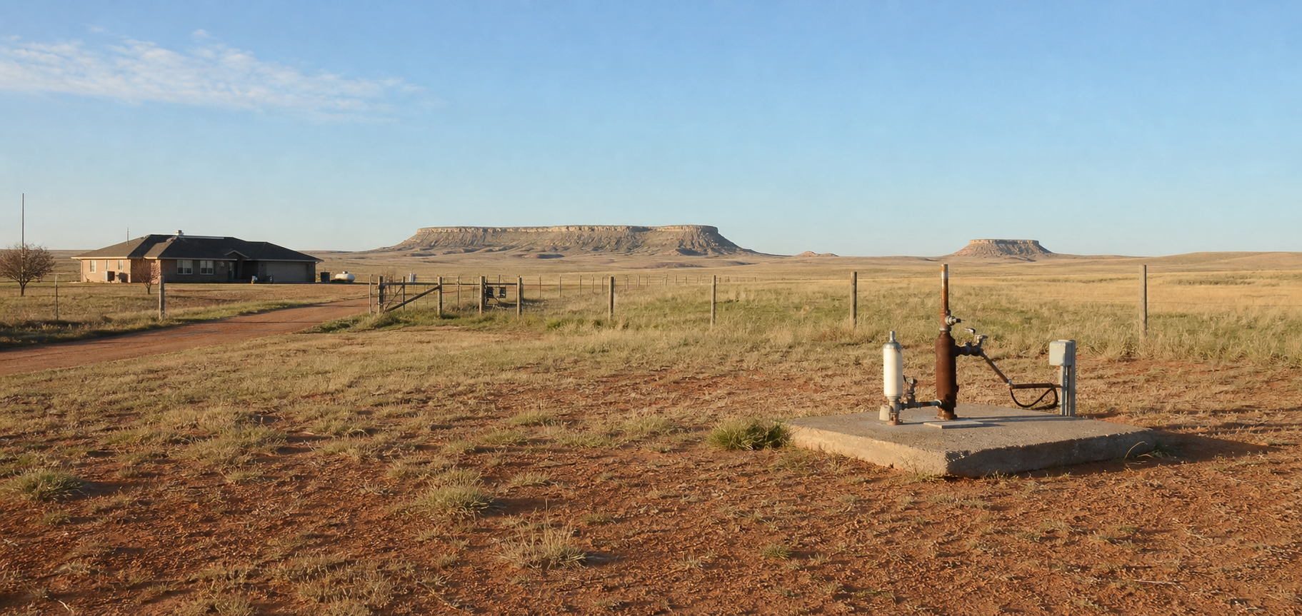
The Dockum Aquifer is the kind of Texas groundwater page that punishes lazy assumptions. Buyers hear “West Texas” or “Panhandle” and jump straight to one story. Some think every tract is really an Ogallala tract. Others think the deeper Dockum label automatically means a big expensive industrial well with ugly water. Both shortcuts can be wrong. The Dockum can support household, ranch, stock, irrigation, and public-supply work, but it does not behave like a one-number aquifer. The practical question is whether the property sits where the Dockum is the actual producing story, whether the nearby records are domestic or heavy-use noise, and how much chemistry risk comes with the depth you are budgeting.
That is why the Dockum shows up in land deals as a hidden second conversation. Plenty of acreage in the Panhandle and adjoining West Texas counties is marketed with broad water language that really belongs to the High Plains as a whole. The moment the tract depends on the Dockum instead of the Ogallala, or depends on both in different nearby completions, the planning lane changes. You may be dealing with deeper targets, more variable yield, more mineralized water, or district rules that buyers never priced into their first draft budget.
This page is built for the people who actually have to make the decision: land buyers, existing well owners, sellers, agents, ranch families, and rural homeowners. It combines current Texas Water Development Board facts with the TurnkeyWells groundwater record so you can see the Dockum the right way. That means separating domestic evidence from irrigation and industrial noise, reading the aquifer in the context of the High Plains system, taking the chemistry warnings seriously, and using TurnkeyWells tools before you lean on the wrong comparable well.
Quick Facts About the Dockum Aquifer in Texas
| Planning item | Practical property-owner meaning |
|---|---|
| Aquifer type | confined and unconfined. The Dockum shows up both where it is exposed and where it sits below younger aquifer material. |
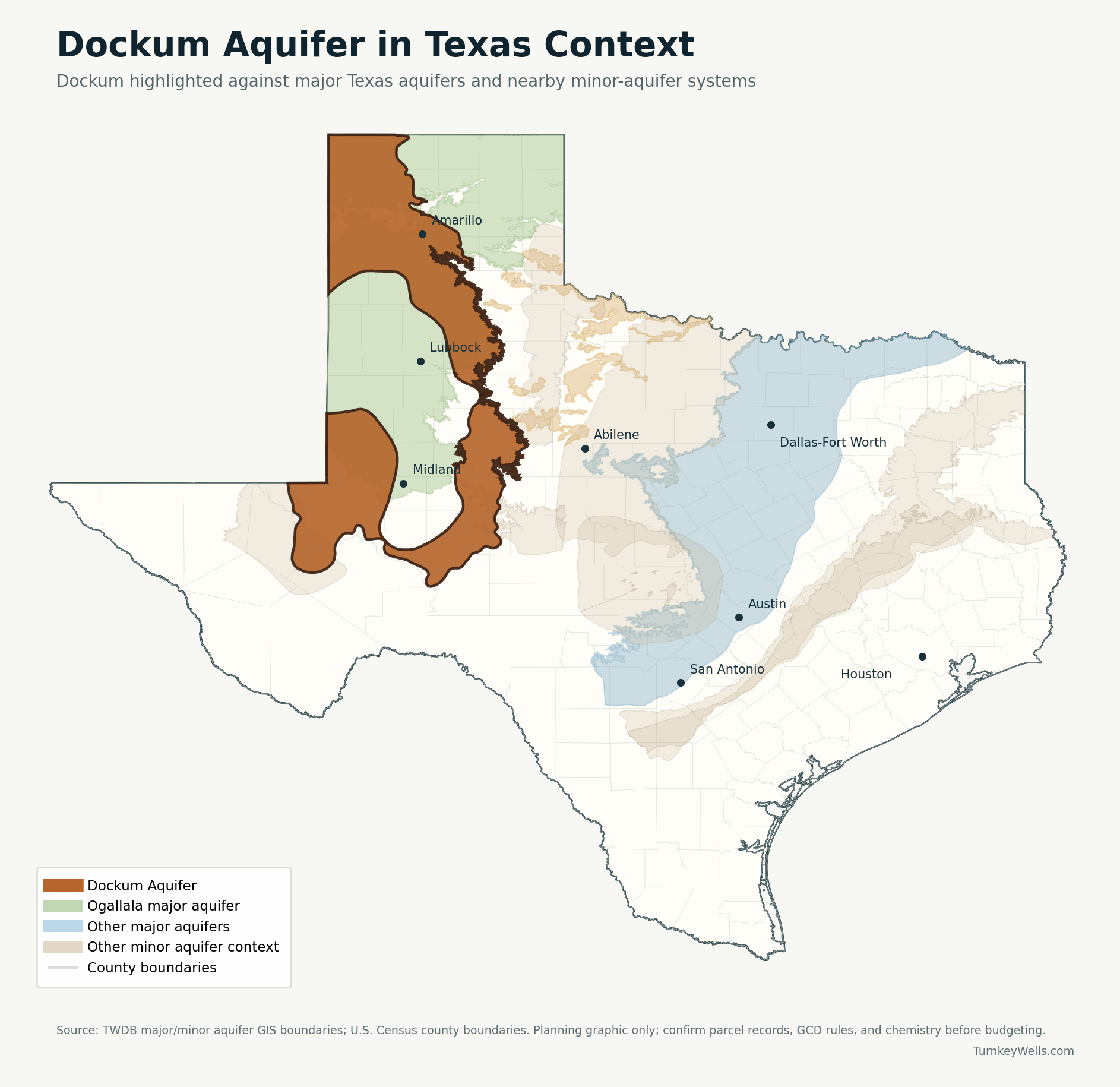
| Texas extent | 3,525 square miles of outcrop plus 22,030 square miles of subsurface area across 46 counties. |
| Groundwater district coverage | About 55 percent of the aquifer lies inside groundwater conservation district jurisdiction, so a county name alone is not enough to clear the rule question. |
| TurnkeyWells exact tagged records | 2,349 GWDB wells tagged exactly Dockum, with 2,121 usable depth values. |
| Typical exact-tag depth signal | Median about 215 feet, with the middle half running from about 150 to 380 feet and the 90th percentile near 872 feet. |
| Domestic exact-tag depth signal | 385 exact-tag domestic rows with a 143-foot median and a middle band of about 78 to 241 feet. |
| Submitted driller-report domestic signal inside the official footprint | 25,230 domestic rows with a 208-foot median and a 445-foot upper planning marker. |
| Main water-quality warning | TWDB says water quality is generally poor and very hard, with gross alpha, radium, nitrate, chloride, fluoride, iron, sulfate, and dissolved-solids issues showing up often enough to change the budget. |
| High-volume distortion risk | Irrigation, public-supply, industrial, and unused legacy wells all show up in the record set. Sorting by use is mandatory before you trust a nearby depth number. |
What the Dockum Aquifer Actually Is
The Texas Water Development Board describes the Dockum as a minor aquifer in the northwest part of the state and part of the broader High Plains Aquifer System alongside the Ogallala and Rita Blanca aquifers. Geologically, it is tied to the Dockum Group, a package of sandstones, conglomerates, mudstones, and siltstones. For a property owner, the key translation is simple: this is not a clean, uniform limestone aquifer or a one-layer shallow alluvial story. The Dockum is a layered sedimentary system that can produce water, but the quality and behavior change with location, depth, and use history.
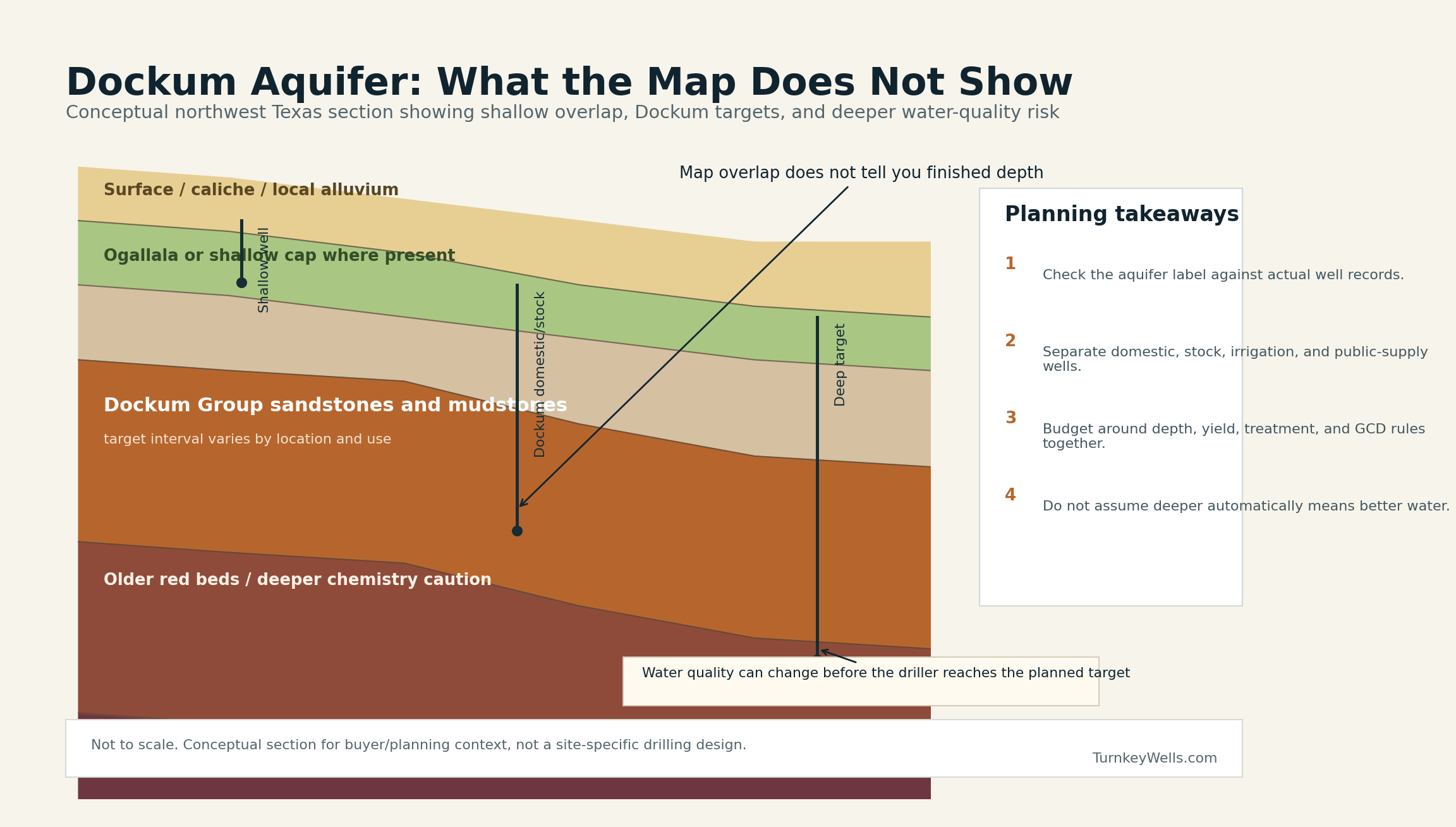
TWDB also notes that the Dockum is overlain by the Ogallala except where the Ogallala has been eroded away in outcrop areas near the Canadian and Colorado River country. That distinction keeps real estate chatter from collapsing the whole region into “Panhandle groundwater” when the tract-level question is really which aquifer the well will rely on and whether the nearby records even belong to the same completion logic. A tract with shallow Ogallala influence and a tract leaning on the deeper Dockum may sit in the same county and still deserve completely different drilling expectations.
The lower boundary matters too. Permian red-bed shales underlie the Dockum and act as a no-flow lower boundary. In practice, that means the Dockum is not an endless downward open invitation to keep drilling until the problem goes away. Deeper is not automatically safer. In some parts of the footprint, deeper can mean heavier-use well types, more mineralized water, or a budget that belongs to a different category of project entirely.
Why the Dockum Confuses Buyers More Than It Should
The confusion starts with aquifer overlap and record noise. In the public mind, northwest Texas acreage often gets sold with Ogallala shorthand because that name is famous. In the database, some counties show Ogallala and Dockum side by side, and a buyer who pulls only one or two nearby records may not notice which formation actually drove the well. In other places, the exact Dockum story is present, but the record set is crowded with irrigation, industrial, or unused wells that make a normal rural household budget look either much cheaper or much more extreme than it should.
The second problem is chemistry. The Dockum is not just a depth page. It is a quality page. TWDB says the water is generally poor and very hard. That does not mean every Dockum well is a disaster, but it does mean a buyer who focuses only on “How deep do I need to drill?” is asking the wrong first question. A well that can produce usable household water with treatment is a very different planning result from a well that looks workable on depth alone but carries enough hardness, nitrate, dissolved solids, or radionuclide exposure to change the equipment and testing budget.
The third problem is that the Dockum spans enough geography to encourage sloppy averages. Mitchell County, Scurry County, Potter County, Randall County, and Oldham County do not tell the same property story. Some slices carry more domestic-friendly evidence. Others are dominated by irrigation or by deeper non-household work. The aquifer name stays the same while the practical planning lane changes under your feet. That is why TurnkeyWells uses parcel-level well review and why we are skeptical of anyone quoting one famous county depth as if it settles the whole matter.
Depth Patterns: What the Record Actually Says
In the TurnkeyWells exact-tag GWDB sample, the Dockum shows a 215-foot median depth, with the middle half of usable rows ranging from roughly 150 to 380 feet. That is already a warning not to build a budget from a single shallow or deep anecdote. The 90th percentile lands near 872 feet, which tells you the exact-tag footprint still includes a serious upper-end tail. A buyer who uses only the median number is likely to under-budget a meaningful share of real properties.
The use split is even more important. Domestic exact-tag rows in this sample carry a median of about 143 feet. Stock wells show a median near 170 feet. Irrigation wells cluster around a 210-foot median, and public-supply wells sit around 275 feet, with broader upper-end ranges. That means the same aquifer name is covering small-household, ranch, and heavy-production objectives that should never be blended into one generic planning number.
The official-footprint driller-report data makes the same point from a different angle. Inside the mapped Dockum footprint, TurnkeyWells found 25,230 domestic submitted driller-report rows with a 208-foot median total depth, a middle band of about 140 to 300 feet, and a 90th-percentile planning marker near 445 feet. The pump-depth side is thinner but still useful: 2,143 domestic pump-depth rows show a median around 280 feet. That is why a Pre-Drill report is more honest than a coffee-shop estimate. The spread is real.
Record Snapshot
The Dockum is a use-sorting aquifer. If you blend every nearby well type together, you will either overpay, under-budget, or believe the wrong water-quality story.
County-Level Dockum Snapshots
County snapshots help only when they are used the right way. They are not substitutes for tract work. They are guardrails against bad assumptions. The table below shows why the Dockum can feel manageable in one county and much heavier in another, even before you factor in chemistry or rule differences.
| County | Record density | Depth signal | Main use in exact sample | How to read it |
|---|---|---|---|---|
| Mitchell County | 645 exact-tag depth rows | 172 ft avg / 160 ft median | Irrigation | The biggest exact-tag cluster in this sample and heavily shaped by irrigation. Useful for seeing the Dockum’s core footprint, but not a one-number shortcut for a house well. |
| Nolan County | 271 exact-tag depth rows | 205 ft avg / 200 ft median | Irrigation | A central transition county where moderate depths are common, but use mix still matters before a buyer treats one nearby well as a guarantee. |
| Scurry County | 253 exact-tag depth rows | 301 ft avg / 267 ft median | Irrigation | A stronger deeper-irrigation slice. It shows how fast the Dockum can stop looking like a modest household project. |
| Randall County | 72 exact-tag depth rows | 512 ft avg / 502 ft median | Irrigation | Panhandle context where many buyers first think Ogallala. Helpful because it proves some tracts still lean on the deeper Dockum story underneath. |
| Potter County | 56 exact-tag depth rows | 253 ft avg / 264 ft median | Domestic | One of the cleaner domestic examples in the northern footprint, but still a county where Ogallala and Dockum assumptions can get blended carelessly. |
| Howard County | 51 exact-tag depth rows | 198 ft avg / 167 ft median | Domestic | A mixed county where Ogallala and Edwards-Trinity noise can distort the Dockum signal if the record set is not sorted by use and location. |
| Oldham County | 55 exact-tag depth rows | 257 ft avg / 240 ft median | Stock | Northwestern ranch-country evidence with more stock use in the mix. Good for showing that the Dockum is not just a Snyder-Sweetwater story. |
| Motley County | 44 exact-tag depth rows | 144 ft avg / 123 ft median | Stock | A smaller shallower stock-oriented slice that keeps the page honest about local spread across the footprint. |
Mitchell, Nolan, and Scurry are especially useful because they show the core southern Dockum story without pretending it is all domestic. Mitchell is packed with exact-tag rows and still leans heavily irrigation. Scurry pushes the reminder further by showing how fast the upper end can widen once heavier-use wells dominate the sample. Nolan is a good sanity check in the middle, because it keeps the conversation closer to the kind of moderate-depth numbers buyers love to seize on while still refusing to flatten the use mix into one clean answer.
Randall and Potter matter for a different reason. They sit in country where plenty of buyers and agents instinctively think first about the Ogallala. Those counties show why the deeper Dockum still has to be part of the conversation on some properties. Oldham and Motley keep the picture from becoming too metro or irrigation-heavy. They show that the Dockum is also a ranch and stock-well page, not just a city-edge or large-farm page.
Water Quality: This Is Where the Dockum Gets Expensive Fast
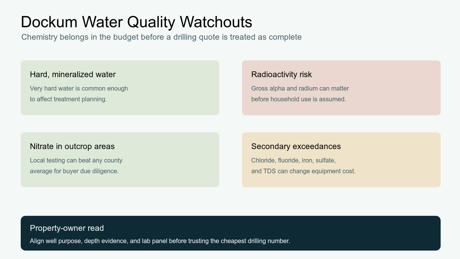
TWDB’s Dockum summary is unusually blunt by Texas aquifer-page standards. Water quality is generally poor and very hard. That alone should stop anyone from treating a Dockum tract like a simple depth question. Hardness means scaling and equipment wear. Higher dissolved solids change taste and treatment needs. Iron and sulfate can turn an “existing working well” into a very different ownership experience after closing. A well that technically produces water can still be an expensive well.
The more serious warning is naturally occurring radioactivity. TWDB says gross alpha exceeds the state’s primary drinking-water standard in about 25 percent of Dockum wells. Radium-226 and -228 also occur above acceptable standards. That is not a footnote. It means certain Dockum properties deserve a more disciplined testing conversation before the buyer assumes the water is ordinary. If a seller hands over a stale general water test with no radionuclide context, that is not the same thing as a modern decision-ready dataset.
Nitrate is another clear risk, especially in outcrop areas where agricultural activity is part of the local story. TWDB says nitrate exceeds primary standards in about 10 percent of Dockum wells. That does not justify panic, but it absolutely justifies testing. The Dockum is one of those pages where “We can test later” is a dangerous sentence in a purchase contract or new-drill budget. Later is when the surprise gets expensive.
Then there are the secondary standards that still matter to daily life: chloride, fluoride, iron, sulfate, and total dissolved solids exceed recommended levels in about one-third of tested wells. These are not purely academic. They show up in staining, taste, odor, scaling, appliance wear, and the size of the treatment conversation. This is why TurnkeyWells tells buyers to separate “Can this property get a well?” from “What will the finished water actually be like?” On the Dockum, those are not the same question.
Buying or Selling Property With an Existing Dockum Well
If the property already has a well, the right first question is not whether water comes out of the tap today. It is whether the record file, test history, and nearby comparable wells support the way the property is being marketed. A functioning well with a thin file and no recent quality data is not the same asset as a documented well with modern testing, driller records, pump information, and a clear sense of how the water behaves in dry conditions.
For buyers, the Dockum raises the importance of the seller file. Ask for the driller report, any pump or service records, treatment invoices, and the most recent lab results. If the lab work is old, narrow, or missing the chemistry issues this aquifer is known for, budget for updated testing before the contingency window closes. A seller saying “The water has always been fine” is not a substitute for a modern panel when the aquifer has real hardness, nitrate, dissolved-solids, and radioactivity exposure in its public summary.
For sellers, hiding behind a vague “private well on site” description is a bad move. Dockum buyers who know what they are looking at will ask harder questions anyway, and the confident answer is documentation. A current test panel, clean wellhead conditions, realistic system description, and a clear statement about any treatment equipment do more for a rural sale than a soft promise that the area has good water. If the system needs attention, it is usually cheaper to surface that early than to let it explode in the last week before closing.
Planning a New Dockum Well
For a new well, the Dockum pushes the decision process back to records and comparables. The optimistic mistake is pretending the nearest well is enough. The pessimistic mistake is finding one very deep or ugly-water Dockum story and assuming every tract will look the same. Neither is good enough. You need nearby wells, the right use category, the right side of the local geology story, the district rule check, and a treatment-aware budget.
The submitted driller-report data suggests that many domestic Dockum wells can still land in a manageable planning band, but the upper tail is too real to ignore. That is why a buyer should treat the 90th-percentile domestic planning marker near 445 feet as a seriousness check, not as a guarantee. If the parcel sits in a local slice where irrigation or deeper non-household work dominates, or where the well history is sparse, the budget should be more conservative until a property-specific report narrows the comparison set.
Well design matters too. The Dockum is not a page where you should assume a driller can simply chase deeper clean water and solve every problem. Screen interval, casing, sealing, and site placement all matter. A household well near an older agricultural area, a homesite carved out of former ranch acreage, or a tract leaning on old legacy infrastructure deserves more scrutiny than a glossy listing usually provides. If a property depends on a well for the whole household plan, the Pre-Drill Intelligence Report is the right next step because it sorts actual nearby records before the budget hardens around bad assumptions.
Groundwater Districts, Permitting, and the High Plains Rule Problem
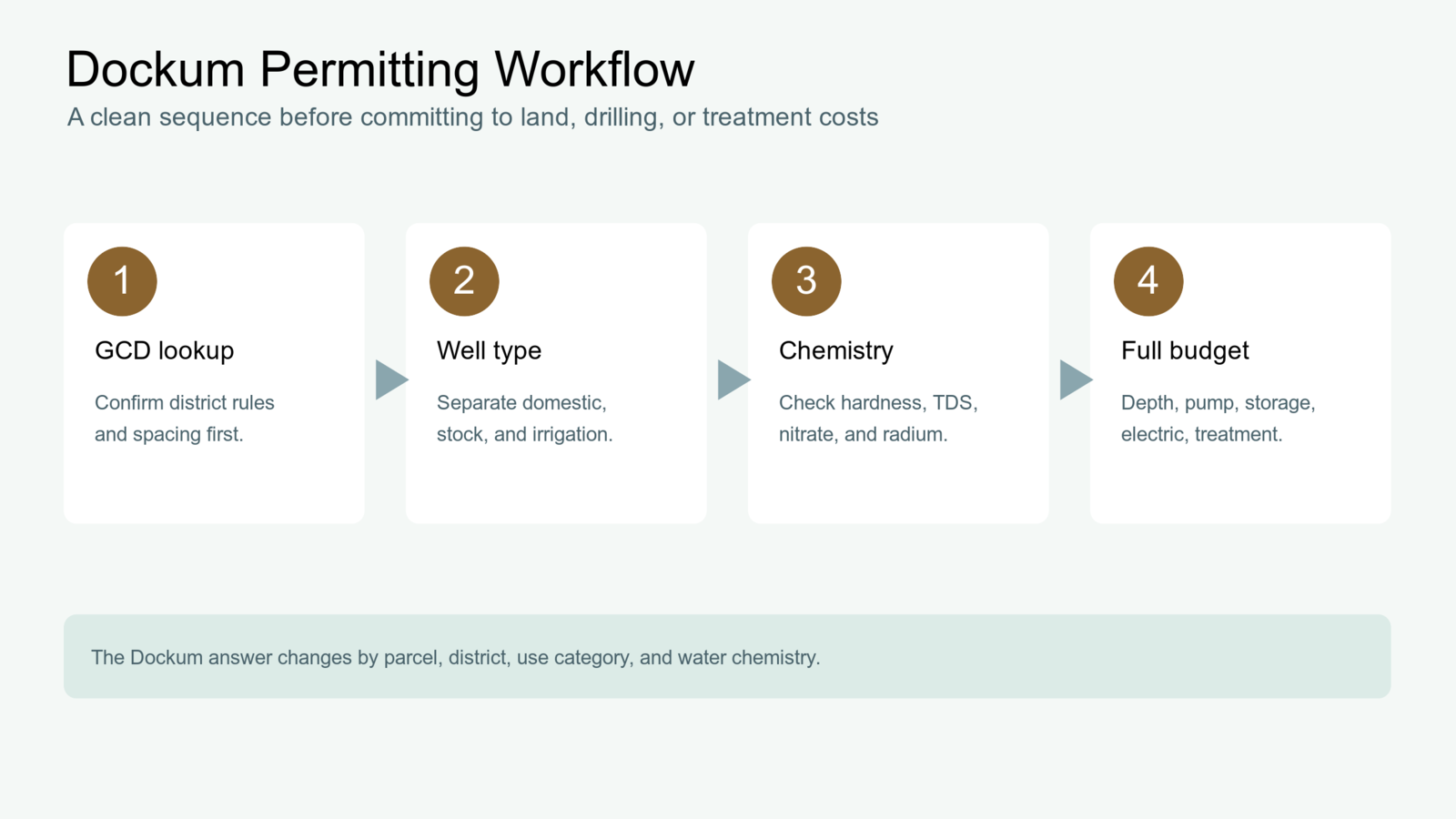
About 55 percent of the Dockum lies inside groundwater conservation district coverage, which means the rule question is neither universal nor optional. The tract might be exempt for some domestic uses and still sit inside a district with registration, spacing, or ownership-transfer requirements that matter. It might also sit in a district where different aquifers or use categories trigger different spacing logic. That is why the TurnkeyWells GCD Lookup tool belongs near the front of the workflow, not as an afterthought.
High Plains Underground Water Conservation District is a good example of why the Dockum needs a separate look. Local guidance notes separate spacing requirements for Dockum or Santa Rosa wells. A buyer who assumes every rule discussion in that region is really just an Ogallala discussion is already behind. The same district may be familiar, but the aquifer-specific treatment can still change what the tract is allowed to do or how the project needs to be laid out.
Rule work also matters on existing-well properties. Transfer registrations, exempt-well paperwork, spacing history, and local reporting obligations can become part of the closing conversation. A parcel that looks simple from the highway can still have a messy water-rights or registration paper trail if nobody checked the exact district lane. TurnkeyWells uses the district result together with the local record set because one without the other still leaves too much room for expensive guesswork.
What Records Matter Most on a Real Dockum Property
The most useful Dockum records are boring on purpose. Buyers often hope for a silver-bullet number or one dramatic geological explanation. What actually helps is a stack of unglamorous evidence that all points the same direction. That usually means nearby domestic driller reports, any existing service or pump records on the subject property, the district answer, and a modern water-quality panel if a well already exists. When those four lanes agree, the Dockum becomes far less mysterious. When they disagree, that disagreement is the signal, not a problem to ignore.
Start with nearby domestic comparables whenever possible. A large irrigation well or a deep industrial record can still teach you something about the aquifer, but it should not be allowed to price a kitchen, two bathrooms, livestock water, and a normal rural homesite demand by itself. A domestic comparison set does a better job of showing what ordinary household success looks like in the local slice of the Dockum. Then layer in the other uses to understand where the upper-end tail, poorer chemistry, or deeper screens start to appear. That sequencing keeps the buyer anchored to the right project type before the scary records or the heroic records hijack the conversation.
The second record lane is ownership reality. If the property already has a well, ask whether the equipment, test history, and driller information support the way the property has been used. A lightly used ranch-house well, a neglected older farm well, and a tract that once supported higher-demand use can all sit inside the same aquifer story while leading to very different maintenance or upgrade costs after closing. The Dockum is one of those aquifers where a weak seller file should immediately raise the question of what is missing rather than letting everyone pretend the absence of records is harmless.
The third lane is local rule context. District coverage is not total across the mapped aquifer, but it is large enough that a buyer should never assume the tract is outside the rule question until the lookup is done. Registration, spacing, transfer, or aquifer-specific requirements are precisely the kind of details that can turn a theoretically workable well project into a slower or more expensive one. The safest workflow is simple: run the rule check before ordering the budget around a driller anecdote.
The fourth lane is chemistry evidence. A Dockum page without a water-quality conversation is only half a page. If the property already has a well, current testing is worth more than confidence. If there is no well yet, the chemistry profile of nearby existing wells deserves as much attention as the depth. Treatment cost, not just drilling cost, is often what separates a smart Dockum acquisition from a cheap-looking mistake. That is why TurnkeyWells treats public records, district context, and water quality as one package instead of three unrelated chores.
How TurnkeyWells Tools Help on a Dockum Property
The free Well Check is the quick first pass. It helps you see whether registered wells are already tied to the property or nearby tract pattern. On the Dockum, the first useful clue is often whether there is a real local completion history at all and whether the nearby record field looks domestic, agricultural, or mixed.
The Pre-Drill Intelligence Report is the stronger next move when the property decision is real. It helps separate nearby wells by use, compare depth ranges more honestly, tie the parcel to the right aquifer story, and reduce the odds that a buyer budgets from one noisy record or one polished listing sentence. On an aquifer like the Dockum, that step can be the difference between a realistic drill plan and a very expensive correction.
The GCD Lookup closes the rule gap. District questions are easy to ignore until a permit, spacing, registration, or transfer issue suddenly delays the project. The Dockum is exactly the kind of aquifer where you want that answer early, because the same region often hosts more than one groundwater conversation at once.
How the Dockum Compares With Other TurnkeyWells Aquifer Guides
If you are evaluating Panhandle property where the famous aquifer name is carrying the sales pitch, read the Ogallala Aquifer guide alongside this one. The two aquifers are connected in the regional story, but they are not interchangeable. The Ogallala is the headline aquifer in much of the High Plains. The Dockum is often the deeper or more complicated conversation underneath that headline.
If the tract sits farther east in country that mixes High Plains and Rolling Plains assumptions, the Seymour Aquifer guide is another useful contrast. Seymour buyers often deal with a much shallower alluvial-style story than Dockum buyers. That comparison helps kill the lazy habit of calling every West Texas well page the same thing.
And if your property search drifts south or west into deeper-project territory, the Edwards-Trinity Aquifer guide helps show how a different aquifer can still create another set of deep-use, rule, and water-quality decisions. The main point is simple: Texas groundwater is regional, but property decisions are local.
The Bottom Line on the Dockum Aquifer in Texas
The Dockum is not a throwaway minor aquifer. It is a real planning layer under a large part of northwest Texas, and it deserves more respect than the usual listing shorthand gives it. The safe play is to treat it as a records-first, chemistry-aware, use-sorted, district-checked aquifer. If you do that, plenty of Dockum properties can be evaluated rationally. If you do not, the same aquifer can turn a cheap-looking tract into an expensive lesson.
That is exactly where TurnkeyWells helps. Start with the Well Check, verify the district, and use the Pre-Drill report before you trust the wrong nearby well or the wrong sales language. On the Dockum, that caution is not overkill. It is just competent Texas groundwater due diligence.